Thunderstorms once again pushing from west to east.
Scattered afternoon thunderstorms expected Sunday.
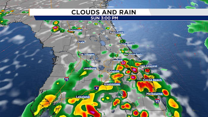
Sunday
Our Sunday Funday will feature a similar scenario as we continue to receive ample moisture from the south and a trough digging into the Southeast to our north. Expect a dry morning with plenty of sun, allowing highs to once again hit the low-mid 90s with “feels like” temperatures around 100-105ºF. Showers and storms will once again push from west to east. Storms will develop around the I-75 corridor around 11am-12pm, push into the I-4 corridor around 2pm, and end up along I-95 late-afternoon. These storms will also fizzle out by sunset.
Moisture lingers to start the work week.
Week Ahead
Lingering moisture will allow rain chances to remain elevated Monday and Tuesday. Storms will primarily be afternoon sea breeze storms lingering for the evening commute.
Ridge of high pressure and Saharan Dust dry Central Florida out and heat us up.
Changes begin mid-week as a ridge of high pressure builds over the state of Florida as our next batch of Saharan Dust arrives. This duo will reduce rain chances to 20-30% by mid week and shoot our high temperatures up into the mid-upper 90s for the second half of the week and into the weekend.
Copyright 2026 by WKMG ClickOrlando – All rights reserved.