
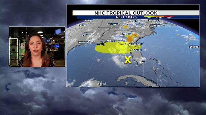
ORLANDO, Fla. – A developing area of low pressure in the eastern Gulf remains the biggest weather story this weekend. While the system only has a low chance of becoming tropical, it will continue to influence Central Florida’s forecast by keeping rain and storm chances elevated through Monday.
Whether it becomes a named system or not doesn’t change our local forecast very much. The biggest impact will be periods of scattered showers and thunderstorms, along with breezy southerly winds.
What it means for Central Florida
Expect another round of scattered afternoon and evening storms today, with the greatest coverage will be focused inland. Storms will be capable of producing frequent lightning, wind gusts up to 55 mph, heavy downpours, and isolated pockets of minor flooding.
Rain chances remain elevated through Sunday and Monday, although forecast trends have shifted the Gulf low a little farther west. That means Central Florida may see slightly less widespread rain than earlier forecasts suggested, but afternoon storms are still expected each day.
Heat Stays in the Forecast
Even with the increase in clouds and storms, it will remain hot and humid. Afternoon highs will reach the low to mid 90s, with heat index values between 100 and 107 degrees.
We’ll Be Watching Closely
The Gulf system will continue to be monitored over the next several days. While tropical development remains limited, Central Florida can expect an active weather pattern through at least Monday.
As confidence increases in the system’s track and strength, we’ll continue to update the forecast both on-air and online.
Copyright 2026 by WKMG ClickOrlando – All rights reserved.
