
Heat indices 100-105 degrees.
ORLANDO, Fla. – Sunday
Heat is sub-advisory level.
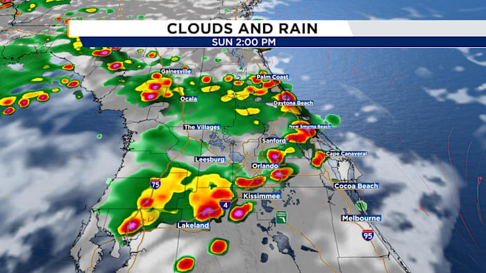
Our Sunday Funday will be another sultry afternoon, however, there is good news! Our heat will be sub-heat advisory levels, meaning not quite as oppressively hot. Highs will still hit the mid 90s with heat indices 100-105ºF. The other good news is better rain chances! A stronger westerly steering flow spells better rain chances for areas around I-4 and eastward in the afternoon.
Rain chances increase for East Coast Sunday afternoon.
We will start seeing spotty storms near I-75 around noon, then push east towards I-4 by 2-3pm. Rain chances continue to push towards the east coast beaches for the second half of the afternoon. These storms will fizzle and fade around sunset.
Next Week
A thicker plume of dust expected for Central Florida to start the week.
Our next batch of Saharan Dust will begin pushing into Central Florida next week. This will allow us to dry out the atmosphere and heat us up at the same time.
Rain chances gradually decline as dust settles in.
Rain chances will be shaved by 10% each day until we bottom out at 20% by Wednesday. Temperatures, in turn, will soar back into the upper 90s with heat indices crossing north of 105ºF.
Copyright 2026 by WKMG ClickOrlando – All rights reserved.
