
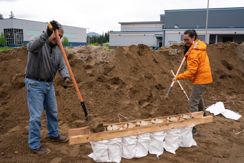
Benjamin Coronell and S’eiltin Jamiann Hasselquist with the Juneau Tlingit and Haida Community Council fill sandbags before the flood in 2025 (Photo by Alix Soliman/KTOO)
Listen to this story:
https://media.ktoo.org/wp-content/uploads/2026/07/09EvacMap-WEB.mp3
The City and Borough of Juneau released a new evacuation zone map in preparation for the glacial outburst flood expected later this summer. At a press conference on Thursday morning, public safety officials said the evacuation zone is larger than last year, although forecasters expect this year’s flood to be about the same size as last year’s record-breaker.
This year, around 1,900 Mendenhall Valley homes are in the glacial outburst flood evacuation zone. That’s nearly double last year’s number of 1,000, and includes homes in a wider margin around the river and farther downstream.
Ryan O’Shaughnessy is the City & Borough of Juneau’s emergency manager. At the press conference, he said the map includes areas beyond where water has reached in past floods.
“To take into account where roads may become blocked and access may be limited by first responders or those evacuating, we’ve broadened our criteria for the evacuation area a little bit,” O’Shaughnessy said.
The flood wall made of HESCO barriers extends along a greater stretch of the river this year.
O’Shaughnessy said that while he’s confident in the flood wall’s ability to protect properties, the barriers can be crushed by trees. That happened to one barrier near the Dimond Park Field House during the flood last August.
“The entire system is fragile, and that’s really why we want everyone in the evacuation area to heed that advisory and to evacuate,” he said.
He said the city will issue an evacuation advisory using text alerts when the flood begins. The American Red Cross will set up an evacuation shelter at Floyd Dryden Middle School again this year.
The 2026 glacial outburst flood evacuation zone. (Image courtesy of City and Borough of Juneau)
If the flood wall breaches, the National Weather Service will issue a flash flood warning and anyone remaining in the evacuation zone will be advised to shelter in place.
The entire flood wall is estimated to cost nearly $50 million this year, split by phases between the city and the U.S. Army Corps of Engineers.
The Army Corps also shipped in more than 40 industrial-sized pumps to bail out water that leaks through the flood wall to prevent property damage. The flood wall protected hundreds of homes during the record-breaking flood last summer, but nearly 50 households still reported damage.
John Bohan, the city’s chief engineer, said that without those additional pumps, the city would only have two. Bohan said staff will begin placing the pumps in valley neighborhoods next week.
“You will see people working on them all the way up to the event,” Bohan said. “You’ll see different tweaks and fine tuning, adjusting hoses, moving things around.”
He said city staff will operate the pumps during the flood, and asks that the public not touch them.
Nick Druyvestein points to the HESCO blocks that were crushed by a tree near Dimond Park Field house during the August 13 flood. (Photo by Alix Soliman/KTOO)
Both the flood wall and the evacuation map account for a flood that’s around 30% larger than last year, at 63,500 cubic feet per second.
That doesn’t mean the flood will be that large, but it is still expected to be big.
Aaron Jacobs is the senior service hydrologist at the National Weather Service in Juneau. He predicts the flood will be around the same size as last year’s record-breaker, which peaked at 48,873 cubic feet per second.
“We are also anticipating a flood, if it releases at a full basin capacity, something very similar to last year, to maybe a little bit lower, but still a major flooding event,” Jacobs said.
He said the water level in Suicide Basin is currently about 90 feet below the overflow channel on Mendenhall Glacier. He estimates it will take another 30 days for the basin to be full. Past floods began between one and six days after that, but the basin can release at any time.
Capital City Fire and Rescue Chief Tom Hatley said he plans to have extra staff available during the flood and boat rescue teams on both sides of the river.
“We’ll be prepared for a worst-case scenario, and again to provide services if need be,” Hatley said.
Travis Eckhoff is the incident commander for the flood at the Alaska Department of Transportation and Public Facilities. He said the state will again fly drones over the flood zone to monitor what’s happening in real-time, including along state-owned bridges. The flood last year damaged an abutment holding up Back Loop Bridge.
“We completed a bunch of repairs and restored that bridge to the pre-flood conditions last year, but it’s still vulnerable to damage during the flood,” Eckhoff said.
When the Mendenhall Lake gage reaches 12 feet this year, Eckhoff said the state will preemptively close Back Loop Bridge. He said Brotherhood Bridge on Glacier Highway should stay open, but the sidewalks will be closed.
City staff said flood zone residents can pick up sandbags at Dimond Park every Saturday, starting July 11, until the flood.
Also at the press conference, City Manager Katie Koester said there will be news about a long-term solution later this month.
We haven’t forgotten about the long-term solution, and how important it is to protect this community,” Koester said. “We will have a really robust update at the July 20 special committee of the whole at Tlingit and Haida Assembly Chambers.”
